
With the 2028 Olympics just under two years from its opening events, more of the logistical details continue to take shape as a plan to implement a network of streets and highway lanes for the Games is a step closer to being finalized.
Under the planned Games Route Network, the California Department of Transportation will allocate 369 miles of roadways, 236 miles of freeway space and 134 miles of local streets for vehicles to transport athletes, coaches, staff, officials and other delegation members from the Olympic Village to over 40 competition venues in L.A. County.
A permit system would keep non-Olympic vehicles off of the roads and guarantee that athletes and staff arrive at the venues on time and be implemented from the start of the Games on July 14, 2028 until July 30, 2028 and through the Paralympics, which begin on August 15, 2028 and end 12 days later.
The proposed routes would be planned around the Olympic Village on UCLA’s campus, where the majority of the athletes will stay during the Games and follow travel schemes that allow for reduced congestion to each venue and back.
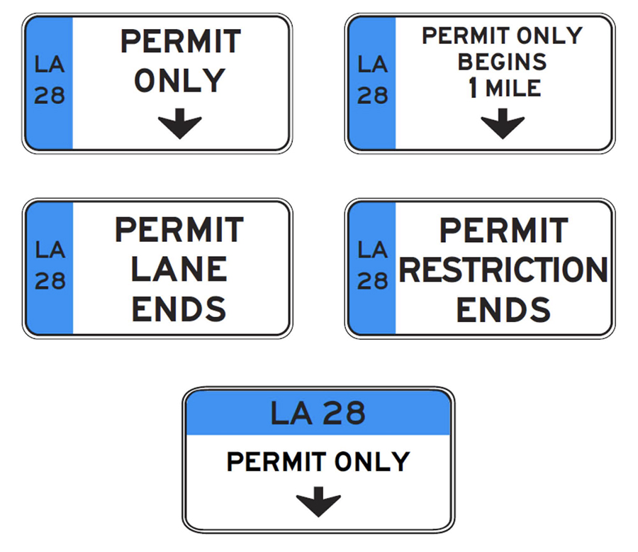
Caltrans describes the routing system as “critical transportation infrastructure and technology enhancements along key freeway corridors supporting the 2028 Olympic and Paralympic Games. These improvements will help ensure safe, efficient, and reliable movement of athletes, officials, spectators, transit users, and the traveling public while providing lasting benefits to California’s transportation system.”
Major roads near the Olympic Village will likely be impacted, including Sunset Boulevard, which runs adjacent to UCLA’s campus, along with L.A. County state routes (1, 2, 47, 91 and 164) and freeways (5, 10, 101, 105, 110, 134, 210 and 405), in addition to Orange County state routes (55, 57, 73 and 91) and freeways (5 and 405), plus a portio of the 5 freeway in San Diego County.
The Southern California Association of Governments is one of several planning agencies that is actively coordinating the mobility planning process with the L.A. Mayor’s Office, the city’s public transit authority, Los Angeles Department of Transportation, Caltrans, Metrolink and Orange County’s transportation authority.
While this is Southern California’s third time as a host city, the LA28 Games will take place in a region that is larger and more complex than it was during past events,” SCAG said in a statement on its website. “The LA28 Games pose a challenge for the region’s transportation system, which must accommodate a surge in spectator and visitor travel while continuing to support transportation needs of the nearly 19 million residents as well as maintain reliable goods movement from the region’s three major ports.”